


(September 20, 2024) Within 6 hours, architect Lisa Hansl completed the data collection for the facades of 21 buildings with a total of 215 residential and commercial units. Digital measurements from Sto Klimaservice together with building data supporting computer-aided design (CAD) now form the basis for the concrete planning of the listed building. There is currently no valid planning data available for the residential area of Weidendamm in the Hanseatic city of Wismar, but the housing association Union Wismar EG wanted to renovate the ensemble dating back to the 1920s and 1930s to make it more energy efficient.
Visualization of the building complex with data from digital measurement. (Image: Sto SE & Co. KGaA)
The residential area in Weidendamm is subject to the conservation laws of the Hanseatic city of Wismar. “That’s why we have only renovated the facades so far, and not upgraded them in terms of energy efficiency,” says Gunnar Schröder, board member of the housing cooperative Union Wismar EG. That should change now. However, there were insufficient plans for the existing building and manual measurements were out of the question due to the size of the residential area. The aim was to register the existing buildings so that scenarios could be drawn up to develop solutions for energy-efficient renovation of the buildings in cooperation with the authorities. Without such solutions, the result would have been demolition.
Up to 1.24 million measurement points
Gunnar Schröder contacted Sto’s project manager, architect Lisa Hansel, who supported the project with Sto Klimaservice. Using a digital laser scanner, she circled the buildings three times and recorded the entire structure to the centimetre. LiDAR technology records every opening, window, door, niche, alcove or balconies with high dimensional accuracy. LiDAR stands for “Light Imaging, Detection and Ranging.” Nicolas Trosch, Managing Director Dutzen GmbHThe company that developed the digital scanner explains the principle as follows: “The scanner scans the environment horizontally and vertically at 360 degrees with up to 1.24 million measurement points.” Lisa Hansl describes the technology as “a huge relief.” In Weidendamm, scanning a façade area of 15,000 square meters took just 6 hours.
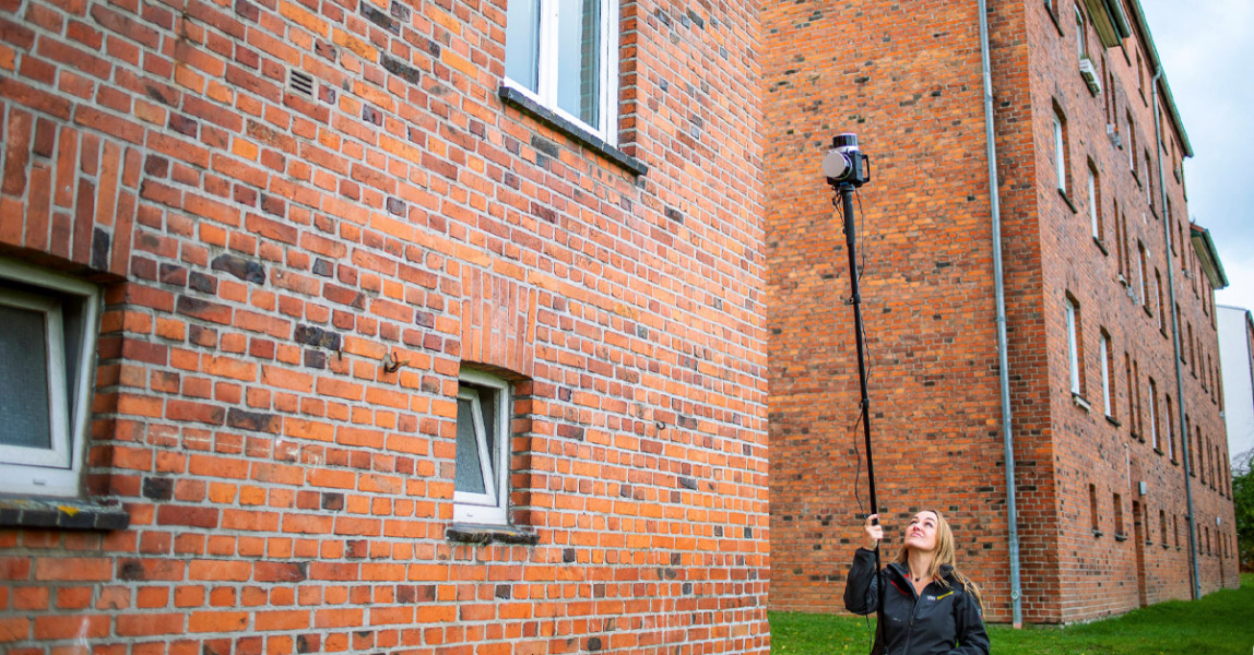
In six hours, architect Lisa Hansel surveyed 15,000 square metres of facade.
(Photo: Nicolas Trosch, dotscene GmbH / Sto SE & Co. KGaA)
reliable accounting basis
The 2D and 3D models developed from the point cloud become the basis for discussion with the authorities in order to find a viable solution for the listed area. This is followed by detailed planning. Based on the survey results, the area and quantity are reliably determined. This provides the basis for the project calculation. The client receives the security planning.
“Once the areas have been accurately calculated, the required amount of insulation, base plaster and top coats can be determined,” explains Silvio Cicura-Buzar, head of digital products and services at Sto. In this way, waste can be reduced. Optionally, individual colour and material concepts from StoDesign are available, also created based on 2D and 3D renderings.
Residential area in Weidendamm, Wismar
- Creator: Cooperative Housing Union Wismar EG
- Scan duration: 6 hours
- region: 15,000 sqm facade
- Floor plan: 1200 meter run
![]() More information can be obtained via Email Sto SE & Co. KGaA It is requested.
More information can be obtained via Email Sto SE & Co. KGaA It is requested.

“Certified tv guru. Reader. Professional writer. Avid introvert. Extreme pop culture buff.”
More Stories
«Using Technology in Winter Service» | City of St. Gallen
Railway renewal at 80 km/h – thanks to special technology
Railway renewal at 80 km/h – thanks to special technology